Jake, Loren, Mike McD, and myself went to the boundary waters in 2002. Loren brought his digital camera and took lots of pictures of the event and now we share those images with you. Even though you really have to be there in person to fully appreciate an experience like this, hopefully by seeing some of these pictures, you'll gain an appreciation for the beauty that is the Boundary Waters Canoe Area (BWCA).
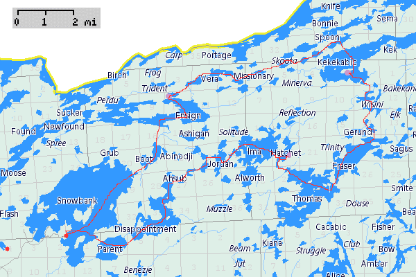
Below is a map that shows the route we took. Out of the 5 days we were in the BWCA, we travelled 4 days and spent one in base camp just to relax.
Our trip was roughly 30 miles. We started at the entry point on Snowbank Lake, travelled most of Monday to Hatchet, then from Hatchet we travelled on Tuesday to Kekekabic, where we stayed Wednesday as well. On Thursday, we travelled to Ensign, and on Friday we came back to Snowbank Lake to the entry point.
Day 0 (packing day)|
|
|
|